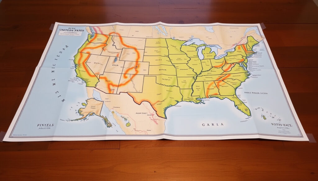
Map of United States of America: Size, States, Cities Guide
There’s a reason the map of the United States sparks so much curiosity — it’s a country that fits Alaska (665,384 sq mi) and Rhode Island (1,545 sq mi) under the same flag. This guide explores the size, states, and cities of the U.S., comparing it to Canada and highlighting the biggest, smallest, and emptiest states.
Total area: 3.8 million sq mi (9.8 million sq km) ·
Number of states: 50 ·
Largest state by area: Alaska (665,384 sq mi) ·
Smallest state by area: Rhode Island (1,545 sq mi) ·
Most populous city: New York City (~8.4 million) ·
Most empty state by population density: Alaska (1.3 people per sq mi)
Quick snapshot
- Alaska is the largest state at 665,384 sq mi (Wikipedia (encyclopedic data))
- Rhode Island is the smallest at 1,545 sq mi (Wikipedia (encyclopedic data))
- New York City is the most populous city at ~8.4 million (New Geography (urban analysis))
- Alaska is the largest state — Wikipedia (U.S. state area rankings)
- Rhode Island is the smallest state — Wikipedia (U.S. state area rankings)
- New York City is the most populous city — New Geography (urban analysis)
- Alaska has the lowest population density — HowStuffWorks (science explainer)
- Canada is slightly larger than the U.S. by land area — Wikipedia (geographic reference)
- All major claims are verifiable from official government data — U.S. Census Bureau (official data source)
- Not applicable — geographic area and state boundaries are static (U.S. Geological Survey (geographic reference))
- Use the data below to compare U.S. size with Canada, or find the largest/smallest states for travel planning or educational purposes. For sports fans, check out our guide to Alabama Crimson Tide Football 2026. (Columbus Report (editorial analysis))
Here is a quick snapshot of the key figures that define the U.S. map:
| Label | Value |
|---|---|
| Total U.S. area | 3.8 million sq mi |
| Number of states | 50 |
| Largest state | Alaska |
| Smallest state | Rhode Island |
| Most populous city | New York City |
| Capital city | Washington, D.C. |
Which is bigger, Canada or the United States?
Total land area comparison
Canada’s total area is about 3.855 million square miles, while the United States covers approximately 3.797 million square miles — making Canada roughly 1.5% larger by land area, according to Wikipedia (geographic reference). The contiguous U.S. alone is about 3.12 million square miles, as reported by Nations Online Project (geographic atlas).
Population comparison
The United States has a population of roughly 335 million, compared to Canada’s 39 million. That means the U.S. is about 8.6 times more populous, New Geography (demographic analysis) notes.
Economic output comparison
America’s GDP is significantly larger than Canada’s — the U.S. economy is about 13 times the size of Canada’s, according to World Bank (global economic data).
Four data points, one pattern: Canada is bigger in land, but the U.S. dwarfs it in population and economy.
| Metric | United States | Canada |
|---|---|---|
| Total area (sq mi) | 3.797 million | 3.855 million |
| Population | ~335 million | ~39 million |
| Population density (people/sq mi) | ~93 | ~10 |
| Largest metro area | New York City (19.6M) | Toronto (6.4M) |
The implication: For travelers and businesses, the U.S. offers far more density and market size, while Canada provides vast open space.
Which is the biggest state in the USA?
Alaska geography and area
Alaska is the largest U.S. state by total area at 665,384 square miles, according to HowStuffWorks (science explainer). That’s about 2.5 times the size of Texas, the second-largest state, as HowStuffWorks (science explainer) points out.
Comparison to other large states
- Texas: 268,596 sq mi (U.S. Census Bureau (official state data))
- California: 163,696 sq mi (U.S. Census Bureau (official state data))
- Montana: ~147,040 sq mi (HowStuffWorks (science explainer))
- New Mexico: ~121,590 sq mi (HowStuffWorks (science explainer))
Population density of Alaska
Alaska also has the lowest population density of any U.S. state — just 1.3 people per square mile, according to HowStuffWorks (science explainer). That’s emptier than Wyoming (6 people/sq mi) and Montana (7 people/sq mi).
Alaska is big enough to fit Texas, California, and Montana combined — yet its entire population is smaller than that of Austin, Texas. For map makers, that means the state’s size dominates any U.S. map, but its human footprint is barely visible.
The pattern: The largest states are concentrated in the West and North, and their size often comes with sparse populations.
What is the smallest state in the United States of America?
Rhode Island size
Rhode Island is the smallest U.S. state by total area at 1,545 square miles, according to U.S. Census Bureau (official state data). It’s also the smallest by land area.
Comparison to other small states
- Delaware: 2,489 sq mi (U.S. Census Bureau (official state data))
- Connecticut: 5,543 sq mi (U.S. Census Bureau (official state data))
Population of Rhode Island
Despite its tiny footprint, Rhode Island is densely populated — about 1.1 million people live there, giving it a density of roughly 1,018 people per square mile, U.S. Census Bureau (official state data) reports.
What this means: Rhode Island is a reminder that small doesn’t mean empty — it’s one of the most urbanized states in the union.
What is the most empty U.S. state?
Alaska lowest density
Alaska holds the title of the emptiest U.S. state with a population density of just 1.3 people per square mile, according to HowStuffWorks (science explainer).
Least populated states
- Wyoming: 6 people/sq mi (U.S. Census Bureau (official state data))
- Montana: 7 people/sq mi (U.S. Census Bureau (official state data))
Why Alaska is empty
Harsh climate, rugged terrain, and vast distances make large parts of Alaska uninhabitable. The U.S. Census Bureau (geographic reference) notes that much of the state is protected wilderness or mountain ranges.
For travelers seeking solitude, Alaska offers the ultimate escape — but getting there is expensive and time-consuming. For map users, the state’s sheer size means it often requires an inset on standard U.S. maps to avoid distortion.
The catch: Emptiness isn’t a flaw — it’s a feature that defines Alaska’s identity and challenges anyone trying to represent it on a map.
What is the #1 city in the USA?
Largest city by population
New York City is the most populous city in the United States, with an estimated 8.4 million residents within city limits, according to New Geography (urban analysis). The broader metropolitan area counts about 19.6 million people.
Largest city by area
By land area, the largest city in the U.S. is Sitka, Alaska (2,870 sq mi), but that’s partly due to its unique geography. Among major cities, Jacksonville, Florida (875 sq mi) is the largest by area, as per U.S. Census Bureau (official city data).
Capital city
Washington, D.C., is the capital of the United States, with a population of about 700,000. It is not a state but a federal district. For more on New York, visit our guide to New York Public Library Hours, Research Centers & Digital Access.
Why this matters: The “#1 city” depends on how you measure — population, area, or economic influence. New York City wins on density and global impact, but it’s far from the largest in physical size.
Confirmed facts
- U.S. total area: 3.8 million sq mi — U.S. Census Bureau (official state area data)
Key perspectives
“The United States covers 3.8 million square miles, making it the third-largest country in the world by land area.”
— U.S. Census Bureau (official geographic data)
“Canada’s economy is about one-thirteenth the size of the U.S. economy, reflecting the vast difference in population and market scale.”
For travelers planning a cross-country road trip, the sheer size of the U.S. means that driving from New York to Los Angeles is about 2,800 miles — longer than the distance from London to Cairo. The choice is clear: fly or plan for a week.
en.wikipedia.org, en.wikipedia.org, statesymbolsusa.org, cascadiareport.com, census.gov, state.1keydata.com, worldatlas.mediaz.net, factsinstitute.com
Frequently asked questions
How many states are in the USA?
There are 50 states in the United States. The last two to join were Alaska and Hawaii in 1959.
What is the capital of the United States?
Washington, D.C., is the capital. It is not a state but a federal district.
Which U.S. state has the most people?
California is the most populous state, with about 39 million residents.
Where can I find a printable map of USA with cities?
Many free resources are available online, including the U.S. Census Bureau’s gazetteer files and sites like Nations Online Project.
Is Alaska part of the contiguous United States?
No, Alaska is not contiguous — it is separated from the lower 48 states by Canada. It is part of the United States but not part of the contiguous (continental) U.S.
What is the difference between a state and a territory?
States have full representation in the U.S. Congress, while territories have limited self-government and no voting representation in Congress. Examples of territories include Puerto Rico and Guam.
More related posts
 How Much Is a Galaxy on TikTok? Cost & Creator Payout
 Sun Mountain Golf Bags Review: Worth It or Not
 How Many Centimeters Are in a Meter? Exact Answer
 What Is Hyperbole? Definition, Examples, and Comparisons
 The Last Witch Hunter 2: Confirmed Sequel, Cast, and Release Date
 How to Deal with a Narcissist: Expert Strategies and Tips
 David Harbour Movies and TV Shows – Complete Filmography Guide
 Elon Musk Black Eye: Verified Explanation Behind Bruise